A web-based application that gathers crowdsourced data to identify flooding in coastal communities went live days before Hurricane Helene struck, allowing scientists to collect essential data during the storm.
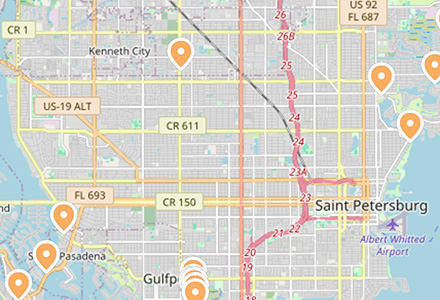
A team of researchers led by the University of South Florida-St. Petersburg GIS and Remote Sensing Professor Barnali Dixon used the CRIS-HAZARD app to analyze real-time flooding in Pinellas County, home to 588 miles of coastline in Florida.
The app, developed with researchers at Georgia Tech, combines volunteered geographic information and community crowdsourced data such as photos and videos with near real-time data on flooding. Using dynamic modeling and mapping tools, including artificial intelligence (AI), the app can identify and extract estimated water elevation from imagery submitted that will be used to inform emergency managers and policymakers.
The CRIS-HAZARD app had a soft launch on September 18. On September 26, Hurricane Helene hit Florida’s west coast as a Category 4 hurricane. Images gathered of the storm’s impact are helping the team gather important information about how much flooding occurred and where in the Tampa Bay area.
“People used it to report what was happening in their backyard,” said Dixon, who is also executive director of USF’s Initiative on Coastal Adaptation and Resilience (iCAR). “This information is their lived experience, and we want to take that experience and make data out of it using AI tools that will process images and figure out the depth of the water. We can use that data to calibrate and validate models.”
In 2023, Dixon received a $1.5 million National Science Foundation grant to build the app. Since then, her team has made significant progress. They have installed 11 cameras in St. Petersburg, with 33 more planned throughout Pinellas County.
The cameras are placed in front of five-foot poles with reflective tape to show flooding as it happens. Each strip is placed six inches apart. Images captured by the cameras indicate that about 3.5 feet of water rose above the seawall in many locations during the storm.
The new app, which provides an interactive user experience, is based on the existing Community Resiliency Information System (CRIS), a website created in 2020 by iCAR.
The CRIS platform leverages crowdsourced data to identify climate-related vulnerabilities in local communities. Residents can input information related to issues such as flooding and power outages. This information can then be used by policymakers and neighborhood leaders to make decisions about policy and resource allocation. The data also allows emergency managers to identify areas with concentrations of people who need transportation assistance or are reliant on power for medical needs.
Dixon has been working with community leaders in St. Petersburg’s Childs and Bartlett Park neighborhoods for several years, where residents have successfully used the system to prepare for extreme storm events. Through the CRIS website, participants can view maps and see their risk of storm surge and sea level rise. They can also share their own information and suggest ways to improve the system.
As principal investigator, Dixon developed the app alongside co-principal investigators Yi Qiang from the USF School of Geosciences and two others from Georgia Tech, Subhrajit Guhathakurta from the College of Design and Peng Chen from the College of Computing.
The research team will continue to work with community partners in St. Petersburg and other flood-prone coastal areas of Pinellas County to refine the app. As the CRIS-HAZARD app gains users and data, the team hopes to make it available to communities nationwide.
Original article by Sarah Sell, University Communications and Marketing
 Lessons From 25 Years Leading Accident & Health at Crum & Forster
  Insurance Groundhogs Warming Up to Market Changes
  Beazley Agrees to Zurich’s Sweetened £8 Billion Takeover Bid
  Winter Storm Fern to Cost $4B to $6.7B in Insured Losses: KCC, Verisk