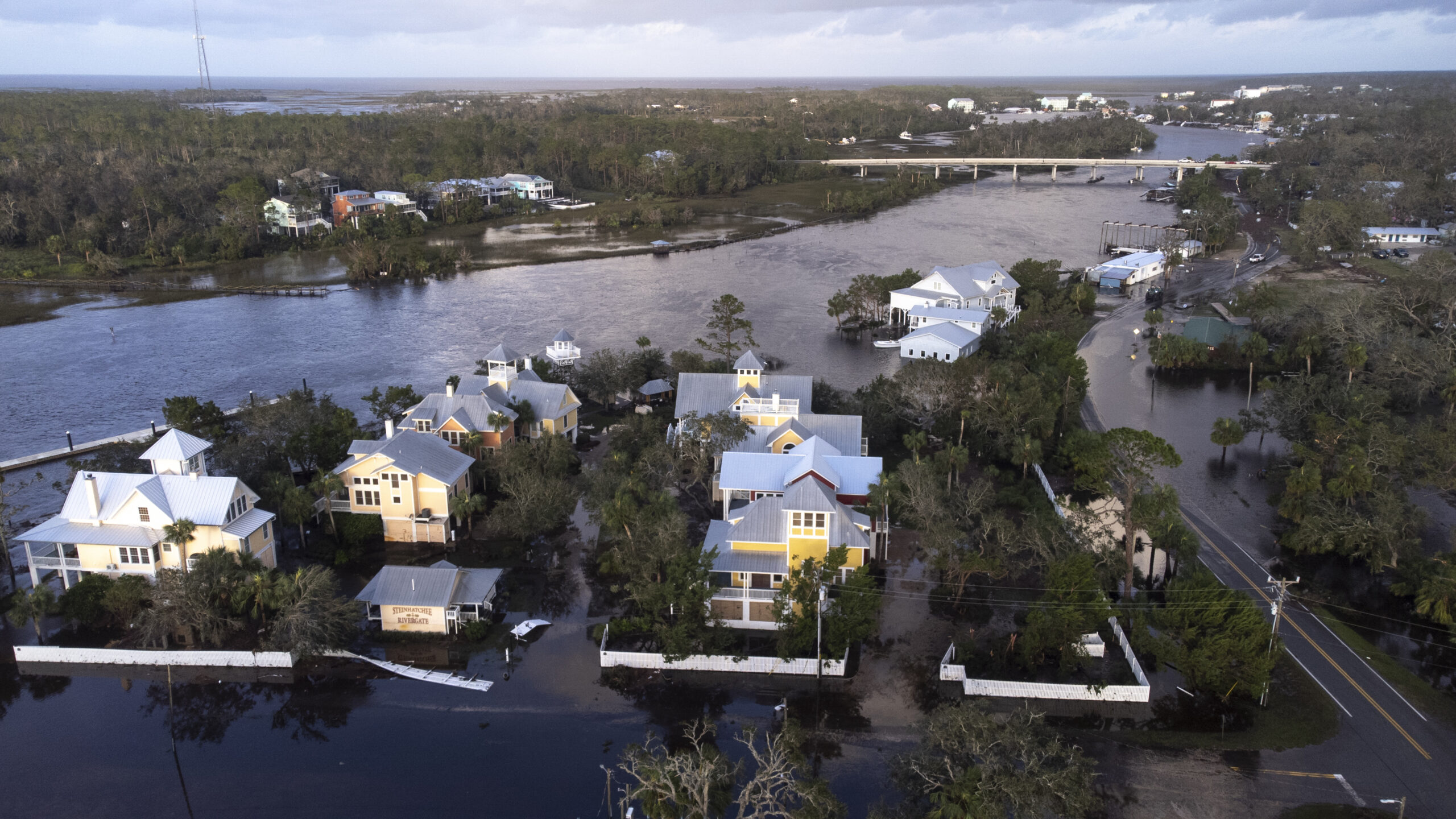
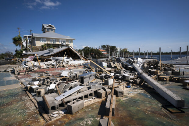
For more than a century, Florida’s Taylor County saw the fewest hurricane strikes of any place on the U.S. Gulf Coast. In the last year, that peace has been shattered.
Helene, which has killed more than a hundred people across the South, was the third hurricane to hit the county in roughly the past 13 months. It followed Debby in August and Idalia about a year earlier. Forecasters aren’t sure why the area’s storm activity has surged, but they point to a couple of potential culprits: Hot oceans and La Niña.
The perils of Taylor County highlight a stark reality for residents of Florida’s coastal communities: There is no safe place. Climate change is altering the way storms behave, threatening regions that were once shielded from the worst effects of extreme weather. As more people move to the U.S. South, lured by the region’s economic growth and relatively low cost of living, the risk of catastrophic losses from natural disasters is rising.
From 1900 to 2023, only two hurricanes struck Taylor County — a rural corner of Florida’s Big Bend region, where the Panhandle meets the rest of the peninsula — and none of them were Category 3 or higher on the five-step Saffir-Simpson scale. That was the least activity anywhere along the entire shoreline from Florida’s southern tip to Brownsville, Texas, according to National Hurricane Center records.

While it’s not clear which atmospheric conditions have been directing more storms into western Florida in recent years, the Gulf of Mexico has gotten warmer, providing fuel for tropical systems.
“I don’t know if something has changed in terms of steering, but the Gulf is unnaturally warm due to climate change,” said Ryan Truchelut, president of commercial forecaster WeatherTiger LLC.
It’s not the first time western Florida has been a magnet for storms. Throughout the late 19th century, the region was quite active compared to the eastern side of the state, said Phil Klotzbach, a hurricane researcher at Colorado State University. Storm strikes then centered around the east coast starting in the 1920s before moving back to the Gulf side in recent years.
Climate-driven ocean heat, coupled with the predominance of the La Niña weather pattern across the equatorial Pacific in recent years, may be changing where hurricanes take shape — and ultimately, where they make landfall, Klotzbach said. Storms forming in the Caribbean, as opposed to the eastern Atlantic near Africa, are more likely to make landfall along the west coast of Florida, he said.
The activity hasn’t just been focused on western Florida. The entire Gulf of Mexico has seen an uptick in major hurricanes with winds of 111 miles per hour or more, said Dan Brown, branch chief at the US National Hurricane Center.
Brown said natural variation in storms’ intensity and location happens. From October 2005 to August 2017, no major hurricane hit the US mainland, which was a record long streak that only ended when Harvey hit Texas. While Superstorm Sandy directly caused more than 100 deaths across the Caribbean and US in 2012, its wind speed was well below Category 3 when it made landfall in New Jersey.
Tropical cyclones are pushed along by larger weather patterns, which sometimes line up in just the right way to produce devastating results. In a forecast previewing the current Atlantic hurricane season, AccuWeather Inc. warned about continued strikes in Florida’s Panhandle and Big Bend. This was mainly because of similarities to specific past years, as well as warm water in the eastern Gulf, said Alex DaSilva, a meteorologist with the commercial forecaster.
DaSilva said it’s difficult to link storm tracks to climate change, but what is known is that as the planet warms up, there is more hot water to fuel stronger cyclones. In recent years, the Gulf Coast has been battered by the most ferocious storms, including Michael in 2018, one of only four Category 5 hurricanes to hit the contiguous U.S.
So far this year 11 storms have formed across the Atlantic and four hurricanes have hit the U.S. The six-month hurricane season ends on November 30, so there is potential for more mayhem. There’s currently a disturbance in the southwestern Caribbean, although it has only a 40 percent chance of becoming a tropical depression in the next week.
“It has been extremely busy in the U.S. since 2017, with just a tremendous number of landfalling hurricanes,” the hurricane center’s Brown said.
Top photo: Sean Rayford/Getty Images


 Berkshire-owned Utility Urges Oregon Appeals Court to Limit Wildfire Damages
  How Americans Are Using AI at Work: Gallup Poll
  RLI Inks 30th Straight Full-Year Underwriting Profit
  Execs, Risk Experts on Edge: Geopolitical Risks Top ‘Turbulent’ Outlook