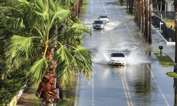
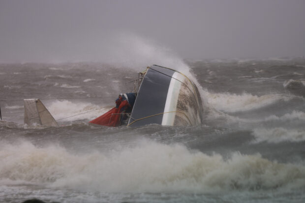
Hurricane Helene barreled into the western coast of Florida with dangerous winds, knocking out power for more than a million customers and threatening to unleash deadly flooding across several states.
Helene made landfall near Perry with top sustained winds of 140 miles (225 kilometers) per hour, according to the U.S. National Hurricane Center, making it a Category 4 on the five-step Saffir-Simpson scale, before weakening to a tropical storm.
“Life-threatening storm surge, winds and heavy rains continue,” the NHC said in an updated advisory at 5 a.m. ET. The storm is packing winds of 70 miles per hour.
Several hurricane and tropical-storm warnings have been discontinued along parts of Florida’s east and west coasts, the NHC advisory said. The tropical storm warning has been ended for the Florida Keys, including the Dry Tortugas.
Helene’s massive size means it’s expected to bring torrential rain and flooding to cities hundreds of miles away, including Atlanta and Asheville, N.C. Prior to making landfall, its outer winds extended out 310 miles, with the storm causing widespread disruptions to ground and air travel.
Over 1.3 million homes and businesses are without power across the southeast US, according to PowerOutage.us, with the vast majority in Florida. The storm also shut in about a quarter of Gulf of Mexico oil production and a fifth of gas activities, according a Thursday notice from the Bureau of Safety and Environmental Enforcement.
Helene plowed ashore in Florida’s rural Big Bend region, near the state’s capital Tallahassee, which has a population of about 200,000. Governor Ron DeSantis said it would be one of the strongest storms to strike at the city in memory.

The system strengthened as it neared landfall, with its top winds edging up to 140 miles per hour in the final two hours before coming ashore, according to NHC advisories.
The National Weather Service’s Tallahassee unit warned in its latest update on X that “dangerous storm surge continues along the Big Bend coast.” However, “winds will be gradually diminishing through the morning.”
“Water levels this morning are just peaking, with the surge 2-3 feet higher than previous records around Tampa Bay and up to Cedar Key,” said Jennifer Hubbard, warning coordination meteorologist, National Weather Service Tampa Bay Area. “With the incredibly broad wind field with Helene, we also saw tropical-storm-force winds across the area, with some hurricane-force gusts in the lower 80 mph range in St. Petersburg and in the Egmont Channel.”
Total damages and economic losses may reach $15 billion, depending on how long Helene can sustain its most dangerous winds, said Chuck Watson, a disaster modeler with Enki Research. Helene is the fourth hurricane to hit the U.S. Gulf Coast this year.


 Insurance Groundhogs Warming Up to Market Changes
  Berkshire-owned Utility Urges Oregon Appeals Court to Limit Wildfire Damages
  Preparing for an AI Native Future
  Allianz Built an AI Agent to Train Claims Professionals in Virtual Reality