


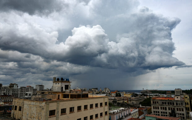
Hurricane Helene pushed deeper into the Gulf of Mexico as the system tracked toward Florida, where it’s forecast to make landfall Thursday evening as a punishing Category 4 storm.
Helene’s winds rose to 90 miles (145 kilometers) per hour, the U.S. National Hurricane Center said in its latest advisory, warning preparations to protect life and property “should be rushed to completion.” The storm is currently a Category 1 on the five-step Saffir-Simpson scale.
Related story: Southeast U.S. on Hurricane Watch as Helene Surges Its Way
The hurricane is forecast to peak at 130 mph before crossing the coast, making it a Category 4, and there’s a chance the storm could be even stronger. Helene is expected to bring catastrophic winds and storm surges to the northeastern Gulf coast, the NHC said, along with heavy rain.
The U.S. National Oceanic and Atmospheric Administration — which oversees the hurricane center — issued a rare warning Wednesday evening that Helene will cause life-threatening flooding hundreds of miles inland, which could last for days after making landfall. The risk is highest in Tallahassee, Atlanta and Asheville, N.C.
“Recent rainfall in these areas, especially the southern Appalachians, have left the grounds saturated and the river tributaries running high,” NOAA wrote. “Additional rainfall from Helene will exacerbate the existing flood risk.”
While Helene is forecast to make landfall in Florida’s rural Big Bend region, it will drop as much as 18 inches of rain across the state and the US South as it moves inland, leading to widespread power outages and disrupting ground and air transportation. Rivers will rise, leading to days of flooding in some areas. The Big Bend is still recovering from Hurricane Debby, which struck that part of the state in early August.
Damages and economic losses may reach $20 billion depending on how long Helene holds onto its most dangerous winds, said Chuck Watson, a disaster modeler with Enki Research.
Helene is so large there is a chance dangerous storm surge could inundate all of western Florida, including Tampa Bay far to the south of where it’s forecast to come ashore, according to the NHC. Helene’s forward speed also means its winds will still be strong as it punches its way inland. The storm’s tropical-storm-strength winds extend 345 miles, roughly the distance between New York City and Montreal, Quebec.
“We’re analyzing it as a similar size to an Irma or a Katrina,” said Lisa Bucci, a hurricane specialist with the NHC in Miami. “It’s big. So, if you’re just focusing on intensity at the center, that’s not a good place to be. You could be in an area of where a storm surge watch or warning is up and there’s evacuation warnings in effect, and if you’re not reacting to those, you’re not prepared.”
Residents along the coast also may be surprised by the depth of Helene’s storm surge, owing to the storm’s size, said Ryan Truchelut, president of WeatherTiger LLC. Additionally, there could be wind damage to crops in southwest and central Georgia.
Mandatory and voluntary evacuations have begun in 23 counties along Helene’s path, according to the Florida Division of Emergency Management. In addition, Governor Ron DeSantis declared an emergency in all but six of Florida’s 67 counties. Sarasota County asked residents in several neighborhoods to start leaving their homes Wednesday, according to the county’s website. Georgia Governor Brian Kemp also declared an emergency across his state.
Amtrak canceled its Crescent Service trains in both directions and its Silver Service will skip stops in Tampa and Lakeland, the federally-funded passenger carrier said on its website. In addition, flights have been grounded through Thursday, with the majority of them out of Tampa, according to FlightAware, an airline tracking service.
As a safety precaution, oil and gas companies have evacuated some offshore workers in the Gulf of Mexico and shut in 29 percent of oil production and nearly 17 percent of current gas production.
Photo: Yamil Lage/AFP/Getty Images
 Flood Risk Misconceptions Drive Underinsurance: Chubb
  Five AI Trends Reshaping Insurance in 2026
  Winter Storm Fern to Cost $4B to $6.7B in Insured Losses: KCC, Verisk
  Beazley Agrees to Zurich’s Sweetened £8 Billion Takeover Bid