The Atlantic hurricane season opened with empty seas and low expectations as two storms raged off the western coast of Mexico, where they will almost certainly stay.
Hurricane Andres, which formed last week and grew into a major Category 4 system, was joined Monday by Tropical Storm Blanca. Blanca’s winds are forecast to reach 140 miles (225 kilometers) per hour, Category 3 major-storm strength, while Andres weakened Tuesday to a Category 2.
“When the Atlantic is less active, the eastern Pacific tends to be more active,” said Dan Kottlowski, expert senior meteorologist at AccuWeather Inc. in State College, Pennsylvania. “It is like a see-saw type situation.”
Mexico’s western coast could be in for another long season of strikes and threats. Last year, 20 named storms rose out of the eastern Pacific, the most since 1992, according to the National Hurricane Center in Miami.
Among them was Odile, the strongest storm to hit Mexico’s Baja California peninsula since Hurricane Olivia in 1967. It killed 11 people, stranded thousands of tourists for days at the resorts around Cabo San Lucas and caused more than 12 billion pesos ($150 million) in damage, according to a center analysis.
2015 Outlook
This season, which began May 15, may bring 15 to 22 named storms, the National Oceanic and Atmospheric Administration said last week. Of those, seven to 12 may become hurricanes and five to eight major systems. The 1981-2010 average is for 15 named storms, eight hurricanes and four major systems.
By contrast, NOAA called for a below-average six to 11 named storms in the Atlantic, where the season opened Monday, while Colorado State University’s hurricane forecasters predicted nine systems would form. Storms get names when their maximum sustained winds reach 39 mph.
One reason for the difference in the two basins is El Nino, a warming of the equatorial Pacific. El Ninos bring wind shear across the Atlantic that can tear apart tropical storms and hurricanes, said James Franklin, branch chief of the National Hurricane Center. The warmer water in the Pacific also provides the fuel for storms in that basin.
Numbers alone don’t guarantee safety in the Atlantic or disaster in the Pacific. They just raise or lower the odds, depending on where you are standing.
Well, almost.
Larger Forces
Kottlowski said larger weather patterns may bring trouble in unexpected places from unanticipated sources. Take Texas, for example.
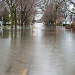
Texas has come through a spring of flooding rains that has turned a state once parched by drought into one that has seen people drowned and property washed away in the past few weeks.
As Blanca comes apart, there is a chance some of its moisture could end up in the U.S. Southwest.
“I am not sure where the end game is on this thing,” he said.
Last year, the remains of three Pacific storms brought flooding rains across the southwestern U.S.
So while people in Texas may take heart from an Atlantic outlook that says their chances of taking a storm head-on are lower, the soggy ground they stand on may get more than a few more opportunities to flood in the next six months.
“If I were in Texas, I would be keeping a very close eye on the eastern Pacific,” Kottlowski said. “That is probably going to be the real joker in the card deck this year.”


 20,000 AI Users at Travelers Prep for Innovation 2.0; Claims Call Centers Cut
  Flood Risk Misconceptions Drive Underinsurance: Chubb
  How Americans Are Using AI at Work: Gallup Poll
  AIG, Chubb Can’t Use ‘Bump-Up’ Provision in D&O Policy to Avoid Coverage


